Ohhh 56. Not 65. K I am gonna stay off talking about choppers for a while. Sorry for knocking this off topic. There are a few pictures of thunderbolts from seattle out there if the Original Poster would like me to link a couple?Brendan W wrote:Dual tones have been around since the late '50s. I think the earliest dual tone unit was a 4/5 that dated back to 1956 or 1957 that I believe was in either Minneapolis or Cincinnati.coastalsyrolover wrote:Yea that's what I thought. If I remember it right dual tone didn't come in until... 1963? 65? I am probably way off but yea they were all single tone. Thanks stormsetter.stormsetter4 wrote:All of them were single toned. Dual tone was not introduced until later.
-
coastalsyrolover
- Registered User

- Posts: 1777
- Joined: Thu Feb 27, 2014 10:01 pm
- Real Name: Christian Long
- Location: Wonderful Western Oregon.
Re: Seattle/Tacoma Thunderbolts
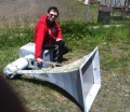
Own and love a Thunderbolt 1000 and a Model 5.
I have many hobbies and interests. And I love them all.
Christian, Lima, Oscah, November, Golf.
I have many hobbies and interests. And I love them all.
Christian, Lima, Oscah, November, Golf.
-
PugetSoundStormWatch

- Registered User
- Posts: 674
- Joined: Tue Apr 30, 2013 10:50 pm
- Real Name: Anthony
- YouTube Username: MiltonWATech99
- Location: Milton, WA
- Contact: Skype Twitter YouTube
Re: Seattle/Tacoma Thunderbolts
TelcoJoe, you seem a little familiar. Are you ACACyclone120, aka JoJoes123 Sirens?
22-year-old Seattle native. Green River College.
I like DJ equipment, Weather Radios (23 in my collection), Fire Alarms, and Sirens.
Future Meteorologist! Go Hawks!
I like DJ equipment, Weather Radios (23 in my collection), Fire Alarms, and Sirens.
Future Meteorologist! Go Hawks!
Re: Seattle/Tacoma Thunderbolts
No. I am new to this board. I have lived in Seattle my whole life (between Seattle and Bellevue). I was wondering when they stopped testing them as I think I would have heard them in the early 70's.PugetSoundStormWatch wrote:TelcoJoe, you seem a little familiar. Are you ACACyclone120, aka JoJoes123 Sirens?
I've always been interested in them and happy I found this forum. I now work in Emergency Management for a local government, but it's a different ballgame compared to the Civil Defense days.
While growing up, I remember seeing the one Thunderbold on 22nd, a federal sd-10 near Mountlake, the Crysler sirens up north, and a Model 5 on a pole near Leshi.
Awhile back, while traveling along West Lake Union, I saw the horn portion of a Thunderbolt sticking out of a salvage yard for many years, but it is not visible now.
A friend of mine many years ago said that he could see a siren in the woods on the East side of Beacon Hill. I was never able to locate it.
Lastly, there is a Federal Signal 3T22 in Chelan, Wa that they use for forest fires and it is mounted around 25' above ground level. I had the opportunity to hear it (while driving a block away) a few years ago and I just about urinated myself. Very loud!
-
PugetSoundStormWatch
- Registered User
- Posts: 674
- Joined: Tue Apr 30, 2013 10:50 pm
- Real Name: Anthony
- YouTube Username: MiltonWATech99
- Location: Milton, WA
- Contact: Skype Twitter YouTube
Re: Seattle/Tacoma Thunderbolts
Interesting. I didn't know about some of these locations, especially the 3T22 in Chelan. Anyways, welcome to the board! I happen to live in the SeaTac area myself!TelcoJoe wrote:No. I am new to this board. I have lived in Seattle my whole life (between Seattle and Bellevue). I was wondering when they stopped testing them as I think I would have heard them in the early 70's.PugetSoundStormWatch wrote:TelcoJoe, you seem a little familiar. Are you ACACyclone120, aka JoJoes123 Sirens?
I've always been interested in them and happy I found this forum. I now work in Emergency Management for a local government, but it's a different ballgame compared to the Civil Defense days.
While growing up, I remember seeing the one Thunderbold on 22nd, a federal sd-10 near Mountlake, the Crysler sirens up north, and a Model 5 on a pole near Leshi.
Awhile back, while traveling along West Lake Union, I saw the horn portion of a Thunderbolt sticking out of a salvage yard for many years, but it is not visible now.
A friend of mine many years ago said that he could see a siren in the woods on the East side of Beacon Hill. I was never able to locate it.
Lastly, there is a Federal Signal 3T22 in Chelan, Wa that they use for forest fires and it is mounted around 25' above ground level. I had the opportunity to hear it (while driving a block away) a few years ago and I just about urinated myself. Very loud!
22-year-old Seattle native. Green River College.
I like DJ equipment, Weather Radios (23 in my collection), Fire Alarms, and Sirens.
Future Meteorologist! Go Hawks!
I like DJ equipment, Weather Radios (23 in my collection), Fire Alarms, and Sirens.
Future Meteorologist! Go Hawks!
-
Daniel

- Registered User
- Posts: 4086
- Joined: Sat Jun 03, 2006 3:37 am
- Location: Beautiful eastern Oregon
Re: Seattle/Tacoma Thunderbolts
Actually it was Oregon which abandoned Civil Defense in 1963. I don't know about Washington's history. Before the Thunderbolts, Seattle had a system of dual-tone Decot sirens with Model 5-style housings. Someone recently showed a photo of a small-town fire station in western Washington with two Model 2's and one of those old Decots.
Lex orandi, lex credendi, lex vivendi.
-
Jonas Clark
- Posts: 29
- Joined: Wed Oct 18, 2006 4:47 am
- Location: Seattle, WA
Re: Seattle/Tacoma Thunderbolts
TelcoJoe, could you ask your friend about the one on Beacon Hill? I hunted for it, and I'm determined to locate it-- you and your friend just might be the break I needed. The Seattle archive photo on the VictorySiren site shows a Chrysler on a four-legged metal tower like those at Northacres and Phinney Ridge, on a barren hillside with a diagonal road going up past it. All of that area is wooded and full of houses now, but there are many patches of forest where it could be.
VictorySiren photo here, says it's on a tower "above Rainier Ave." http://www.antiqueweekend.com/x/photo-p ... oto-83.htm Another page on the site says the tower is above Rainier Ave., south of Columbia City.
I found an old municipal siren list, which gave its location as Andover & Letitia. At least today, Andover & Letitia don't cross directly. What's more, Andover & Letitia are NORTH of Columbia City! For the time being, though, I took "Andover & Letitia" as more likely to be accurate.
Here's a map I drew for explanation:
http://imgur.com/Ez1Tom4
In the center of the photo, running vertically, is a hill. Rainier Ave. runs in the valley to the east (right), Martin Luther King Way in the valley to its west. Andover, which is broken up, is in yellow. Letitia in turquoise. I had thought the northern end of 34th Ave. S. (in orange) might be the diagonally-uphill road in the photo, which would put the siren at the location of the blue square-- houses now stand there. I had been hunting in the green forested area. At the corner of 31st & Bradford there are trails going down into the forest where the map says "Lake People Park." I found nothing. The southern end of the park is closest to Andover & Letitia's not-intersection, has no trails, and I couldn't see anything in there, either. I'd think the brown, rusty tower would 'pop' among the green trees.
Then, I spoke with a woman I met on the street near 34th & Letitia (where orange and turquoise lines meet), who told me that she vaguely remembered "a big thing on a tower, up on the hill somewhere" years ago, but did not know, even approximately, where that was, save that she pointed generally west. Last, I went to the Columbia City offices (Chamber of Commerce? Neighborhood Association? I forget) and asked for the longest-tenured employee. He had never seen anything of the sort, but he asked a few others who had lived in the area for a while, with no luck.
I then roamed all over that little hill, hoping to see it in a back yard or something, its tower just obscured by houses and topography. But it really needed to face, or be ON, a slope, and all of the slopes here had houses. I did examine them, on both sides of the hill, without luck. There is a strong chance that Seattle, or a home-builder, cut the tower down years ago and scrapped everything.
However, what if the lists are VERY wrong? What if it is actually above MLK? At the time of installation, perhaps Rainier was THE biggest road in the area. Could it be west of where I've been looking, in the dense forested zone marked "???" Another expedition is probably in order.
Re: Seattle/Tacoma Thunderbolts
Hey Jonas. I have seen that photo before and I too have looked for it, but with no luck. My friend, whom I have not seen in 20 years, lived near 38th Ave S. and Genesee. If he looked outside his window (West toward beacon hill) he said that he could see a siren on the hill during the fall/winter when the trees had no leaves. I think he was looking toward the Jefferson Golf Course area. I looked around there many years ago and could not locate it. It may be in the woods, but there should have been a trail/road to get to it.Jonas Clark wrote:TelcoJoe, could you ask your friend about the one on Beacon Hill? I hunted for it, and I'm determined to locate it-- you and your friend just might be the break I needed. The Seattle archive photo on the VictorySiren site shows a Chrysler on a four-legged metal tower like those at Northacres and Phinney Ridge, on a barren hillside with a diagonal road going up past it. All of that area is wooded and full of houses now, but there are many patches of forest where it could be.
VictorySiren photo here, says it's on a tower "above Rainier Ave." http://www.antiqueweekend.com/x/photo-p ... oto-83.htm Another page on the site says the tower is above Rainier Ave., south of Columbia City.
I found an old municipal siren list, which gave its location as Andover & Letitia. At least today, Andover & Letitia don't cross directly. What's more, Andover & Letitia are NORTH of Columbia City! For the time being, though, I took "Andover & Letitia" as more likely to be accurate.
Here's a map I drew for explanation:
http://imgur.com/Ez1Tom4
In the center of the photo, running vertically, is a hill. Rainier Ave. runs in the valley to the east (right), Martin Luther King Way in the valley to its west. Andover, which is broken up, is in yellow. Letitia in turquoise. I had thought the northern end of 34th Ave. S. (in orange) might be the diagonally-uphill road in the photo, which would put the siren at the location of the blue square-- houses now stand there. I had been hunting in the green forested area. At the corner of 31st & Bradford there are trails going down into the forest where the map says "Lake People Park." I found nothing. The southern end of the park is closest to Andover & Letitia's not-intersection, has no trails, and I couldn't see anything in there, either. I'd think the brown, rusty tower would 'pop' among the green trees.
Then, I spoke with a woman I met on the street near 34th & Letitia (where orange and turquoise lines meet), who told me that she vaguely remembered "a big thing on a tower, up on the hill somewhere" years ago, but did not know, even approximately, where that was, save that she pointed generally west. Last, I went to the Columbia City offices (Chamber of Commerce? Neighborhood Association? I forget) and asked for the longest-tenured employee. He had never seen anything of the sort, but he asked a few others who had lived in the area for a while, with no luck.
I then roamed all over that little hill, hoping to see it in a back yard or something, its tower just obscured by houses and topography. But it really needed to face, or be ON, a slope, and all of the slopes here had houses. I did examine them, on both sides of the hill, without luck. There is a strong chance that Seattle, or a home-builder, cut the tower down years ago and scrapped everything.
However, what if the lists are VERY wrong? What if it is actually above MLK? At the time of installation, perhaps Rainier was THE biggest road in the area. Could it be west of where I've been looking, in the dense forested zone marked "???" Another expedition is probably in order.
Attached is a map of the area he probably was looking at.
- Attachments
-
- map.jpg (57.43 KiB) Viewed 3599 times
-
Jonas Clark
- Posts: 29
- Joined: Wed Oct 18, 2006 4:47 am
- Location: Seattle, WA
Re: Seattle/Tacoma Thunderbolts
Awesome! This gives me new hope, and your information is a gigantic help! I'll ask a buddy if he'll go with me and we'll go looking for trails and take a little hike. Wouldn't it be exciting to find it standing, deep in the middle of the woods? We'll start by driving Cheasty Blvd. S. along the top of the hill. Then, if we don't see it, or if we do but we can't get to it from there, I see a park listed at the bottom called View Point Park which might have trails going up into the hillside.
Do you remember him describing said siren in any particular way? Or saying how he knew it was a siren-- perhaps comparing it to the really visible one on Phinney Ridge? (The Northacres Park Chrysler is pretty well hidden by trees, despite being right beside the street.)
Do you remember him describing said siren in any particular way? Or saying how he knew it was a siren-- perhaps comparing it to the really visible one on Phinney Ridge? (The Northacres Park Chrysler is pretty well hidden by trees, despite being right beside the street.)
Re: Seattle/Tacoma Thunderbolts
I was interested in finding it too back in the day and he just said that he could see it on the side of the hill, but never gave much detail. My guess is that he probably was old enough to remember hearing it or that he was close enough to know what it was. On a side note, I had another friend who said he could see the one on the Washington Athletic Club (looking from the East). He indicated that it was not at the very top, but on a lower tier. This was back in the early 90's.Jonas Clark wrote:Awesome! This gives me new hope, and your information is a gigantic help! I'll ask a buddy if he'll go with me and we'll go looking for trails and take a little hike. Wouldn't it be exciting to find it standing, deep in the middle of the woods? We'll start by driving Cheasty Blvd. S. along the top of the hill. Then, if we don't see it, or if we do but we can't get to it from there, I see a park listed at the bottom called View Point Park which might have trails going up into the hillside.
Do you remember him describing said siren in any particular way? Or saying how he knew it was a siren-- perhaps comparing it to the really visible one on Phinney Ridge? (The Northacres Park Chrysler is pretty well hidden by trees, despite being right beside the street.)
-
Jonas Clark
- Posts: 29
- Joined: Wed Oct 18, 2006 4:47 am
- Location: Seattle, WA
Re: Seattle/Tacoma Thunderbolts
The one on the WAC is also a bit unknown. It was indeed on a lower tier, as per photos of its installation. I had believed it to be on the south or southwest side/corner, which might be visible from the East. I can't see it in satellite photos due to shadows from neighboring buildings, but that doesn't mean it isn't still there. The 80s is when I suspect most got removed; if it was there in the 90s, I'd say it's more likely to be extant.
I KNOW that the following are gone: (1) Police Garage on 5th & Cherry, building demolished in the 80s or 90s. (2) Georgetown Steam Plant, verified removed in the 80s, disposition unknown, but also clearly not on the roof (it was on the north end). (3) Seattle City Light warehouse, removed, an elevated bridge goes past with a clear view of the roof and even its mountings don't show up in satellite photos.
(4) Northacres park, and (5) Allen Elementary, Phinney Ridge, still verified in place. Phinney Ridge has been cosmetically restored and a sign discussing it placed at the base, Northacres Park is rusting away but (I think) intact.
That leaves two unknowns, (6) this one near Columbia City and (7) the WAC. Several years ago, when one could still enter the WAC lobby, I went in and asked the front desk. They referred me to maintenance, who was not in at the time, but did not give me a specific number, just asked me to "call." Now, the lobby itself is off-limits to non-members, but I really need to call them.
Return to “Main Outdoor Warning Sirens Board”
Who is online
Users browsing this forum: Ahrefs [Bot] and 28 guests